File:Dole (Arrondissement) Plan.svg
Jump to navigation
Jump to search

Size of this PNG preview of this SVG file: 324 × 508 pixels. Other resolutions: 153 × 240 pixels | 306 × 480 pixels | 490 × 768 pixels | 653 × 1,024 pixels | 1,306 × 2,048 pixels.
Original file (SVG file, nominally 324 × 508 pixels, file size: 69 KB)
_Plan.svg)
Summary
| Description |
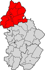
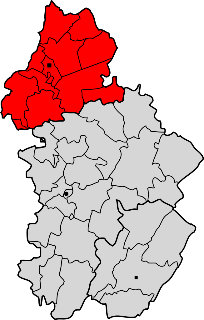
Français : Arrondissement de Dole
Deutsch: Lageplan des Arrondissements Dole im Département Jura. |
| Date | between 2007 and 2008 |
| Source | |
| Author | Pierre Audité |
Licensing
Pierre Audité, the copyright holder of this work, hereby publishes it under the following license:
This file is licensed under the Creative Commons Attribution-Share Alike 2.0 Germany license.
Attribution: Pierre Audité
- You are free:
- to share – to copy, distribute and transmit the work
- to remix – to adapt the work
- Under the following conditions:
- attribution – You must give appropriate credit, provide a link to the license, and indicate if changes were made. You may do so in any reasonable manner, but not in any way that suggests the licensor endorses you or your use.
- share alike – If you remix, transform, or build upon the material, you must distribute your contributions under the same or compatible license as the original.

File history
Click on a date/time to view the file as it appeared at that time.
| Date/Time | Thumbnail | Dimensions | User | Comment | |
|---|---|---|---|---|---|
| current | 11:25, 10 September 2011 | | 324 × 508 (69 KB) | JuTa | version from de:Datei:Dole (Arrondissement) Plan.svg uploaded by de:user:NordNordWest at 2010-02-08 15:08:35 with comment: (update) |
| 11:24, 10 September 2011 |  | 324 × 508 (93 KB) | JuTa | version from de:Datei:Dole (Arrondissement) Plan.svg uploaded by de:user:Pierre Audité at 2007-08-20 15:42:31 with comment: ({{Information |Beschreibung = Lageplan des Arrondissements von Dole im Département Jura. |Quelle = Eigene Arbeit unter | |
| 13:00, 3 September 2011 |  | 324 × 508 (68 KB) | Bildoj |
_Plan.svg)
File usage
The following 2 pages use this file:
Global file usage
The following other wikis use this file:
- Usage on az.wikipedia.org
- Usage on ca.wikipedia.org
- Usage on ceb.wikipedia.org
- Usage on cs.wikipedia.org
- Usage on es.wikipedia.org
- Usage on eu.wikipedia.org
- Usage on it.wikipedia.org
- Usage on pl.wikipedia.org
- Usage on ro.wikipedia.org
- Usage on sk.wikipedia.org
- Usage on tt.wikipedia.org
- Usage on uk.wikipedia.org
- Usage on vi.wikipedia.org
_Plan.svg)