File:Peruskartta 1961 No 2034 06.jpg
Jump to navigation
Jump to search

Size of this preview: 475 × 599 pixels. Other resolutions: 190 × 240 pixels | 381 × 480 pixels | 609 × 768 pixels | 812 × 1,024 pixels | 1,624 × 2,048 pixels | 6,850 × 8,637 pixels.
Original file (6,850 × 8,637 pixels, file size: 9.51 MB, MIME type: image/jpeg)
Summary
| Description |
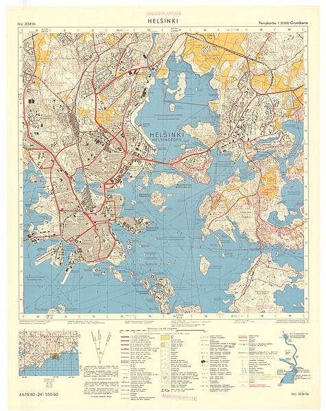
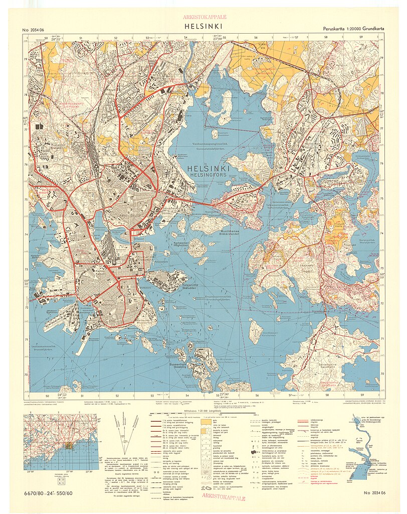
Suomi: Peruskartta 1:20 000 vuodelta 1961, karttalehti 2034 06 |
|||||||||
| Date | ||||||||||
| Source |
|
|||||||||
| Creator |
Maanmittaushallituksen topografinen toimisto |
|||||||||
| Geotemporal data | ||||||||||
| Date depicted | ||||||||||
| Scale | 1:20,000 | |||||||||
| Bounding box |
|
|||||||||
| Georeferencing | ||||||||||
| Bibliographic data | ||||||||||
| Map sheet | 2034 06 | |||||||||
Licensing
This file is licensed under the Creative Commons Attribution 4.0 International license.
Attribution: National Land Survey of Finland 2016
- You are free:
- to share – to copy, distribute and transmit the work
- to remix – to adapt the work
- Under the following conditions:
- attribution – You must give appropriate credit, provide a link to the license, and indicate if changes were made. You may do so in any reasonable manner, but not in any way that suggests the licensor endorses you or your use.
File history
Click on a date/time to view the file as it appeared at that time.
| Date/Time | Thumbnail | Dimensions | User | Comment | |
|---|---|---|---|---|---|
| current | 10:40, 16 June 2016 | | 6,850 × 8,637 (9.51 MB) | Susannaanas | User created page with UploadWizard |
File usage
The following 2 pages use this file: